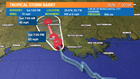
NEW ORLEANS — As of 1 PM Saturday, Hurricane Barry has weakened back to a Tropical Storm after making landfall near Intercoastal City, Louisiana this morning.
- Barry's track has shifted slightly west into the southern Louisiana coastline.
- Barry became the 1st hurricane of the 2019 season
- That classification was short lived, landfall has weakened it back to a Tropical Storm
- Barry's west-northwest movement remains slow at 6 mph.
- Barry's winds have decreased to 70 mph.
- Barry's central pressure has increased to 996 mb..
- The storm made landfall as a hurricane near Intercoastal City, Louisiana.
The next advisory out from the National Hurricane Center is due out at 4
PM.

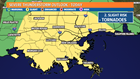
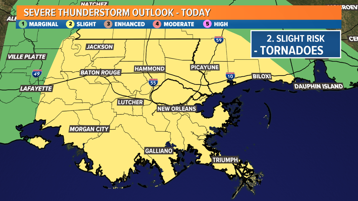
Severe weather and tropical systems go hand in hand. A tropical storm OR hurricane is a very large circulation. The storm already has introduced spin so it makes it a lot easier to flare up tornadoes or waterspouts. Most of these tend to be weaker and short lived but the threat is certainly short lived but the risk is there. Here is the outlook from the Storm Prediction Center for today. We are in the slight risk or level 2 for severe storms.
The storm is expected to move very slowly, right now only moving at 5 mph! This will allow more time for the storm to feed off of very warm ocean waters currently in place in the Gulf of Mexico. Warm waters are fuel for tropical systems. It's forward movement is only at 6 mph and not expected to increase very much.
TROPICAL STORM BARRY: Path, Spaghetti Models, Live Radar
All in all category size should not be what you fixate on. Water is the headline here. A substantial amount of rain is likely, of course dependent on the exact track. With river levels already at record highs it will be easier for flooding to occur.
Let's take a look at what we can expect given what the present computer model runs are showing us and current real time observations are telling us.
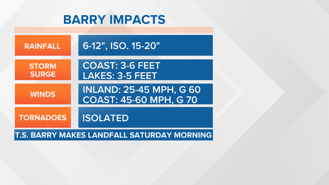

Rainfall will be another problem but it will also be very dependent on the exact track the storm takes. Right now we feel comfortable with rainfall totals on the order of 6-12"+.


Download the FREE WWL-TV News app now in the iTunes store or on Google Play for tropical weather updates through hurricane season.
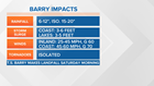
Impacts to New Orleans and Southeast Louisiana
Here's what you can expect from Tropical Storm Barry in the New Orleans metro area:
- 6 to 12 inches of rain - as high as 20 inches in some areas well west, between now and when the storm passes
- Tidal surge of 3-6 feet on the coastline, including in the Mississippi River, where the river levels could reach flood stage.
- More tropical downpours are expected to head our way over the next few days and they could cause street flooding
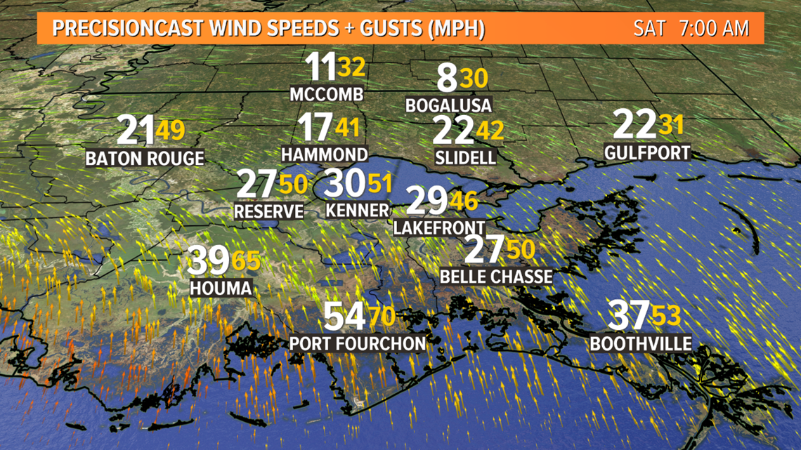
- Winds of 30-60 miles per hour, up to 70+ on the coastline
- Possible tornadoes
---
Stay with Eyewitness News on WWL-TV and WWLTV.com for more on this developing story.