NEW ORLEANS — A tornado warning that was announced for parts of St. Bernard, Jefferson and Plaquemines Parish expired at 11:15 a.m. and is no longer effect.
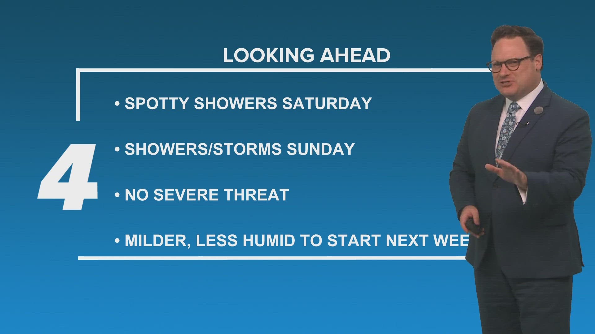
A flash flood watch is now in effect for all of southeast Louisiana until 7 p.m Thursday.
The tornado warning was issued around 10:50 a.m. and came shortly after parts of the Northshore were also issued a warning for about two hours this morning. No substantial damage was immediately reported in either case. The National Weather Service will now work to confirm if tornadoes touched down.
Radar shows that more than six inches of rain fell on Houma and Raceland in just a few hours. At least 2-4 inches had fallen on the rest of the metro area as of noon.
Parking restrictions around New Orleans have been lifted as the National Weather Service upgraded the area to a slight risk (Level 2 of 5) for severe weather. Storms could produce strong gusty winds and a few tornadoes as well as flooding.
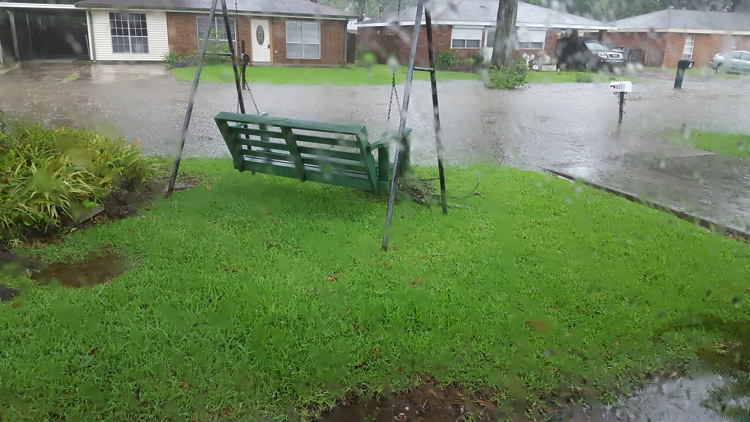
Several streets were reported to be at least partially or fully flooded around the city as of 9 a.m. but have since drained, according to the City's Streetwise flooding map.
Stay with WWL-TV and WWLTV.com for the latest information on flooding and closures.
On June 10, New Orleans and surrounding areas were inundated with water during a surprise severe storm. Streets in Mid-City, Treme and Gentilly were underwater for hours after 3-to-5 inches of rain fell unexpectedly.
The embattled Sewerage and Water Board of New Orleans said the amount of rain was more than any drainage system could handle, but also admitted the water was slow to drain when the utility’s workhorse power-generating turbine – Turbine No. 4 – tripped off as it approached near-peak capacity during the rain.
Since then, S&WB officials said it's changed its protocol to switch on diesel generators under modest rain forecasts, allowing Turbine 4 to operate at a lower capacity.
A tornado warning that threatened parts of the Northshore appeared to leave residents and towns mostly unscathed Wednesday morning, but more rain is on the way.
The warning began around 6 a.m. and included parts of Washington, Tangipahoa (St. Helena, Pike, Amite) and St. Tammany parishes as a strong thunderstorm creating wind rotation passed through the area.
A warning is more severe than a watch, and those in the affected areas were encouraged to seek shelter and stay away from windows.
While there was a significant potential for downed trees, home damage and outages in the wake of the storm, only a few incidents were reported Wednesday morning and appeared to be isolated.
► Get breaking news from your neighborhood delivered directly to you by downloading the new FREE WWL-TV News app now in the IOS App Store or Google Play.