NEW ORLEANS — Ed. Note: This liveblog is being moved to a new URL for our coverage as Hurricane Ida approaches. Click here for the latest coverage:
Hurricane Ida is expected to make landfall in Louisiana Sunday as a Category 4 Hurricane, bringing deadly weather conditions as it crosses over Southern Louisiana.
4 PM: The latest parish-by-parish impacts with the new track: Click here
2:30 PM
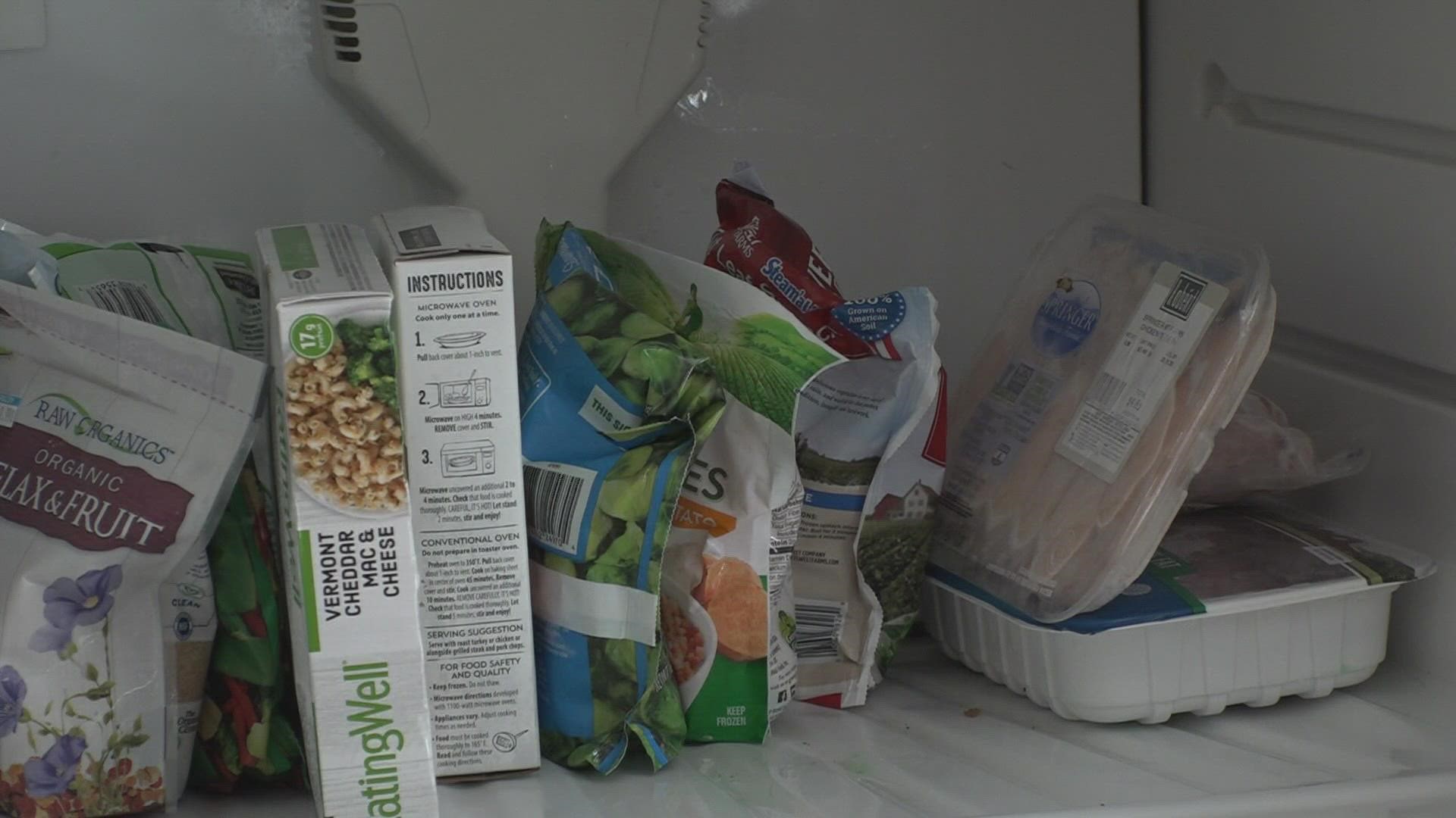
Need to know: Category 4, FEMA arrives, what to do with your refrigerator
1:50 AM
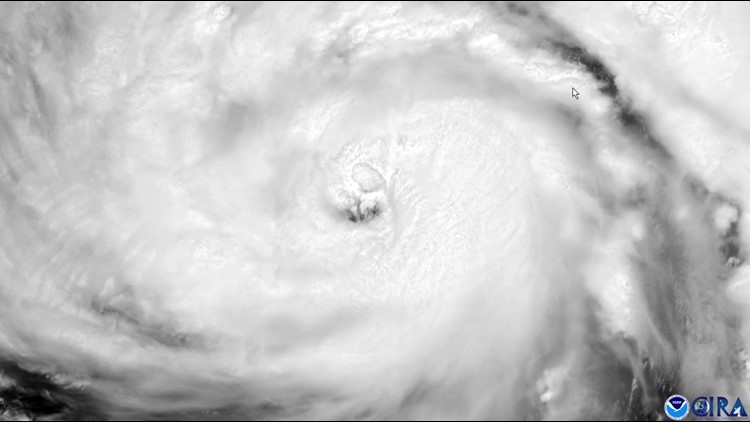
Hurricane Ida is now a Cat. 4 storm
Hurricane Ida is rapidly getting stronger and is now a Cat. 4 storm with 130mph winds
1:30
Evacuees are sharing their traveling troubles as they escape Hurricane Ida.
1:00 AM
Hurricane Ida now a Cat. 3 storm
Hurricane Ida has strengthened to a major hurricane with 115 mph winds. It is still forecast to make landfall as a Cat. 4 storm.
11:50 PM
Floodgate closure:
The LA 23 NB floodgate in Oakville is closed. This floodgate is located on LA 23 NB near the LA 23/Oakville St. intersection.
11:20 PM
The US 11 floodgate in New Orleans East is closed. This floodgate is located on US 11 one half a mile south of the I-10/US 11 intersection.
The LA 47 floodgate in New Orleans is closed. This floodgate is located on LA 47 just north of the LA 47/Downman Rd. intersection.
11:00 PM
Terrebonne Parish is bracing for the storm surge that Hurricane Ida is bringing with it.
10:40
Floodgate closures:
The LA 657 floodgate in Larose is closed. This floodgate is located on LA 657 near the LA 657/Mercer Rd. intersection.
10:30 PM
Jefferson Parish President Cynthia Lee Sheng gives an update on the parish's efforts for Hurricane Ida.
10:00 PM
Mayor LaToya Cantrell gives an update on New Orleans plan for Hurricane Ida
9:00 PM
Welcome Centers will be closed in Tangipahoa and St. Tammany Parishes from Saturday, August 28th at 6:00 pm until Tuesday, August 31st at 6:00 am. Routes included: I-55 Southbound in Kentwood, I-59 Southbound in Pearl River, and I-10 Westbound in Slidell.
7:30 PM
Floodgate Closures:
The LA 46 floodgates are closed. These floodgates are located on LA 46 near the LA 46/Fire Station Rd. intersection
The LA 45 floodgate is closed. This floodgate is located on LA 45 near the LA 45/Merlin Lane intersection.
The LA 39 floodgate is closed. This floodgate is located on LA 39 near the Plaquemines/St. Bernard Parish Line.
7:00 PM
Louis Armstrong International Airport cancels all flights arriving and departing for Sunday.
6:40 PM
Mayor Tim Kerner: " Surge numbers show Lafitte, Barataria and Crown Point will experience significant flooding. So based on that, we made the decision to close the Jean Lafitte title levee by 11 AM Sunday for the protection of our people within levee protection. If you do not leave before 11 AM you will be trapped in for days until the water goes down and without power for a minimum of 10 days."
6:30 PM
National Hurricane Center Director Kenneth Graham provided the President with a briefing on Ida’s projected path and reported that the Gulf Coast was already beginning to feel the effects of the storm.
President Biden convened conversations with the National Hurricane Center and the Federal Emergency Management Agency to discuss the Administration’s ongoing preparations for Hurricane Ida, which is projected to make landfall on the Gulf Coast as a dangerous major hurricane tomorrow on the 16th anniversary of Hurricane Katrina’s landfall.
They discussed ongoing evacuation efforts of Parishes in the storm’s path, as well as the voluntary evacuation of New Orleans. Administrator Criswell told the President that 13 Urban Search and Rescue teams are in place to respond to the needs of people who are not able to get out. The President asked about preparations for nursing homes, and Administrator Criswell said that more than 100 ground ambulances and 20 air ambulances have been deployed to support evacuations of nursing homes in the storm’s path.
6:20 PM
The American Red Cross is opening several evacuation centers across the region for residents wishing to seek refuge during Hurricane Ida.
Red Cross Evacuation Centers:
- St Tammany Parish: Lee Road Junior High School 79131 Hwy. 40, Covington, LA
Creekside Junior High School 65434 Hwy. 41, Pearl River, LA
- Tangipahoa Parish
Amite High School
403 S. Laurel St., Amite, LA
Kentwood High School
603 9th St., Kentwood, LA
Hammond Westside
2500 W. Park Ave., Hammond, LA
- Washington Parish
Franklinton High School
1 Demon Circle, Franklinton, LA
Bogalusa High School
100 MJ Isreal Dr., Bogalusa, LA
The Red Cross will require both staff and residents to wear face coverings inside evacuation centers — regardless of vaccination status. Wearing masks will help to ensure the safety of our workforce and all those we serve during disasters. Our goal is to keep everyone safe from both the disaster threatening the local community and from COVID-19.
Do Bring:
- Masks for every member of the family over the age of 2
- Bedding including pillows
- Clothing
- Prescription Medications
- Your child’s stuffed animal, blanket or other ‘creature comforts’
- Your emergency kit with any foods required to accommodate special dietary needs
Don't Bring:
- Alcoholic beverages
- Illegal drugs
- Weapons
6:00 PM
St. Bernard Parish
Parish President Guy McInnis " Do whatever necessary to secure your home. We will not have a shelter during the weather so please hunker down in your home. Please check on your neighbors and elderly in the neighborhood. All pumping stations are operational and will be manned 24/7 throughout the event.
“The decisions you are making right now could you cost your life.” St Bernard Parish President Guy McInnis
Entergy Louisiana "Entergy has been going through the checklist and are ready to restore power at quickly and safely as possible. 8400 distribution support personal with waiting to acquire a restoration team of about 16,000. Customer prepare for extended restoration times of 7-10 days. restoration could take up to 3 weeks."
5:30 PM
St. Charles Parish residents that have not evacuated are being told to do so immediately. Hurricane Ida’s track has shifted east and will bring significant impacts to St. Charles Parish beginning early tomorrow morning.
5:20 PM
St. John parish issues Voluntary Evacuation for all of St. John Parish.
St. John Parish previously announced a shelter of last resort today at 6:00 p.m. at Emily C. Watkins School located at 938 LA 628 in LaPlace. Residents should bring anything they need including food, clothing, bedding, and medicine. The Shelter will remain open for the duration of the storm.
5:00 PM
Jefferson Parish President Cynthia Lee Sheng
" The storm surge we are expecting is unsurvivable and the storm is not moving quickly. For those in the hurricane protection system, the evacuation window is closing. Most of the deaths from this storm come from water."
" Stay out of the hospital as much as possible. we need to have beds available for those with life-threatening medical issues"
Byron Lee " To residents of West Minster and Lincolnshire if you can do so please do so because the locations are expected to flood as in the past."
Dominick Impastato " Kenner and Metairie resident the two effects to happen are loss of power and water in the streets. All pumps are operational and are staffed and operating."
4:50 PM
MSY: TSA reports 36 cancellations today and tomorrow it’s over 200
“TSA has reported that they do have staffing available right now up to 5 to 6 lanes to get through the check points,” Burns said. “They’re working as hard as they can to process everyone safely and efficiently.”
Burns urges people to check their flight before they come to the airport. So far, 36 flights have been cancelled for Saturday and more than 200 flights have been cancelled for Sunday, when Hurricane Ida is forecast to make landfall.
4:40 PM
The Sewerage and Water Board pump update:
96 of 99 drainage pumps are available for service. The pumps that are down are located at DPS 14 in New Orleans East, DPS 6 in Lakeview near Metairie Road and DPS 12 in Lakeview near Lake Marina Drive.
Regarding power: Turbine 5 is in service, Turbine 6 is ready for use, 4 Electro-Motive Diesel generators are available (EMD #1 is undergoing fan upgrades for noise mitigation) and all Frequency Changers are in service and are ready for use.
Turbine 4 is out of service for repairs, we are working around the clock in an effort to bring the machine back into service, it is currently undergoing testing.
3:45 PM
Residents in New Orleans are now able to park on the neutral ground. Neutral ground parking will be allowed until further notice while the storm passes.
Trash collection in the city has also ended, and residents should secure their trash bins before nightfall, even if they haven't been emptied.
3:15 PM
President Biden has spoken with FEMA adminstrator Deanne Criswell about Hurricane Ida, reassuring her that the post-storm recovery efforts will have any resources needed.
3:10 PM
Plaquemines Parish residents could be without power for up to three weeks, officials warned Saturday.
"We haven't seen a storm like this since Katrina," said Patrick Harvey, the parish's director of homeland security and emergency preparedness."Get out of here if you can."
3:05 PM
TSA is advising passengers to arrive three hours early for flights out of MSY. The airport has already seen many flights canceled ahead of the storm, with the last few flights expected to take off before winds pick up.
2:55 PM
Ahead of Hurricane Ida's landfall, Naval Air Station Joint Reserve Base New Orleans is setting Condition of Readiness 1.
This means that the base will operate with essential personnel only, with all aircraft at the base secured in hangers or sent to other bases.
2:15 PM
Edwards said if you are staying with relatives or friends outside the state, you should have COVID conversations ahead of time.
The pandemic is still ongoing, and exposure is likely in congregate settings.
The governor said about 2,400 COVID patients were hospitalized Saturday, a drop of about 20% from the peak the state has seen in recent weeks. It remains higher than the hospitalization numbers at any other time during the pandemic.
2:10 PM
Edwards told Louisiana residents their window to evacuate is rapidly closing, even as roadways out of the state's metro areas remain clogged with cars full of evacuees.
"This will be one of the strongest hurricanes to hit Louisiana since the 1850s," Edwards said.
2 PM
Gov. John Bel Edwards says the entire state should be on guard for Hurricane Ida, which is expected to trek through much of Louisiana after landfall. The storm could reach Baton Rouge as a Category 1 or 2 hurricane before weakening.
"I dont want folks further inland to be caught off guard," Edwards said.
1:35 PM
Mandeville is issuing a voluntary evacuation for all residents south of Monroe Street in Old Mandeville. A nighttime curfew for the entire city will also go into effect Saturday night.
“Expect widespread power outages for an extended time and 4 to 7 feet of storm surge along the shores of Lake Pontchartrain,” Mandeville Mayor Clay Madden said. "Expect 10 plus inches of rain, and because we are on the east side of the eye there is a chance of tornadoes."
1:25 PM
Plaquemines Parish has implemented a sunset-to-sunup curfew for all areas under mandatory evacuation orders. That includes the entire eastbank of the parish and parts of its westbank.
1:15 PM
St. Tammany Parish officials are expecting widespread flooding after Hurricane Ida reaches the parish. A flash flood watch for the parish remains in effect until Tuesday morning.
Power outages throughout the parish are also expected.
1 PM
Hurricane Ida is now a Category 2 hurricane as it rapidly develops in the Gulf of Mexico.
Ida now has a defined eye, which is one of the best indicators of a powerful and growing storm.
Gusts of up to 140 MPH are expected along the coast when the storm makes landfall.
The next track for the storm will be at 4 PM
12:10 PM
As Hurricane Ida approaches on the 16th anniversary of Hurricane Katrina's landfall, the 2005 storm is at the front of many people's minds. But New Orleans city officials say there is a key difference between Ida and Katrina: major improvements in the city's levee system in the decade and a half after they fell in the first storm.
Cantrell says she is 'very confident' in the levee protection system, which has been overhauled since Katrina exposed glaring failures in the system.
11:50 AM
New Orleans Mayor LaToya Cantrell urged residents in no uncertain terms to evacuate if they were able.
"What I'm told is there's no way this storm will be weakening," she said.
Any residents able to do so should leave the city before the end of the day Saturday, she said.
Because of the speed at which Ida is approaching, the city will only be able to focus on post-storm recovery efforts. And even after the storm, it could be days before help reaches everybody.
Collin Arnold, the city's director of homeland security and emergency preparedness, told residents "the first 72 is on you," about emergency responses after the storm.
11:30 AM
All St. James Parish public schools will be closed Monday as officials assess the damage from Hurricane Ida. St. James is one of the last parishes in the storm's path to announce school closures because of the storm.
It's unclear when schools will reopen again after the storm, because there is still uncertainty about how much damage it will bring.
11 AM
The City of Thibodaux will implement a curfew starting at 6 p.m. tonight until further notice. This storm is expected to be primarily a wind event with the worst of the winds coming between 5 and 9 p.m. Sunday.
10:50 AM
MSY is reporting many flights have been canceled ahead of Hurricane Ida's landfall. Any residents looking to evacuate by flight should check in regularly with the airport and their airline for the latest updates as conditions change.
10 AM
Ida's eye is beginning to form as it moves north through the Gulf. It is expected to strengthen to a Category 3 hurricane by tonight and a Category 4 storm by Sunday morning.
The cone for the storm appears to be largely the same, but has narrowed slightly from the previous update.
9:45 AM
St. Charles Parish officials declared a parish-wide mandatory evacuation order Friday, saying impacts of the storm will be felt for days after landfall.
“Our residents are taking those orders seriously, in fact, yesterday before we called our recommended evacuation I already had people I know letting me know they were being proactive and leaving,” said Parish President Matthew Jewell.
St. Charles Parish could be without power for up to a week or more after the storm.
9:30 AM
Lafourche Parish will begin a parish-wide curfew at 6 p.m. Saturday. The curfew is not for dusk-til-dawn. Instead, it will continue until further notice while the storm passes.
A grace period until 7 p.m. Saturday will allow all employees to get home after businesses close. All essential employees must carry identification indicating their reason for being out after that.
9:10 AM
The City of New Orleans will hold a press conference ahead of incoming Hurricane Ida at 11:15 a.m. Saturday.
Mayor LaToya Cantrell and other emergency management leaders are expected to address the dangers faced by the city.
Yesterday, Cantrell said there was no time to implement a mandatory evacuation of the city, which would take about 72 hours to complete. Instead, she urged everybody able to get out on their own to do so, and for everybody else to hunker down and prepare for power outages that could last for days or weeks.
8:20 AM
"If you have the means to leave, we want you to leave," Jefferson Parish President Cynthia Lee Sheng said. "in Jefferson Parish, every weapon a hurricane has, we're vulnerable to."
Lee Sheng said Jefferson Parish residents live in area that's like a bowl, relying heavily on pumping stations.
"We're not going into this storm full strength."
7:45 AM
St. Bernard President Guy McInnis says the water is already rising in areas outside of the levee protection system.
"Right now, we're asking our residents to prepare," McInnis said. "By noon today, make sure you're going to be in the place you're going to be and shelter there."
McInnis told viewers that they should prepare for extended power outages, heavy rain and strong wind.
"With current forecasts, we're looking at 80 to 100 mph winds here, in St. Bernard Parish,: McInnis said. "One of the good things waking up this morning is seeing people leaving."
7:30 AM
Lafourche Parish residents are under a mandatory evacuation order ahead of the storm. Shelters of last resort are open for residents unable to get out, but parish officials reiterated that they were only for emergencies, and would not have a large cache of supplies for those staying in them.
A curfew has not been issued yet, but officials plan to issue one before the end of the day.
7 AM
Ida is now 385 miles south of the mouth of the Mississippi River, with winds up to 85 MPH and gusts up to 100 MPH. A new track is expected at 10 AM.
6:30 AM
Traffic out of New Orleans has slowed to a crawl headed east or west, with motorists trying to leave while they are still able to ahead of Ida's expected landfall.
Residents have been told to leave by Saturday night, when conditions are expected to deteriorate headed into Sunday.
5 AM
Hurricane Ida is a day out from landfall on the Louisiana coast, with widespread and devastating impacts all but certain for much of the state.
The latest update from the National Hurricane Center has the storm making landfall somewhere between Morgan City and Grand Isle, but officials and weather experts say the entire area should prepare for major flooding, power outages and damage.
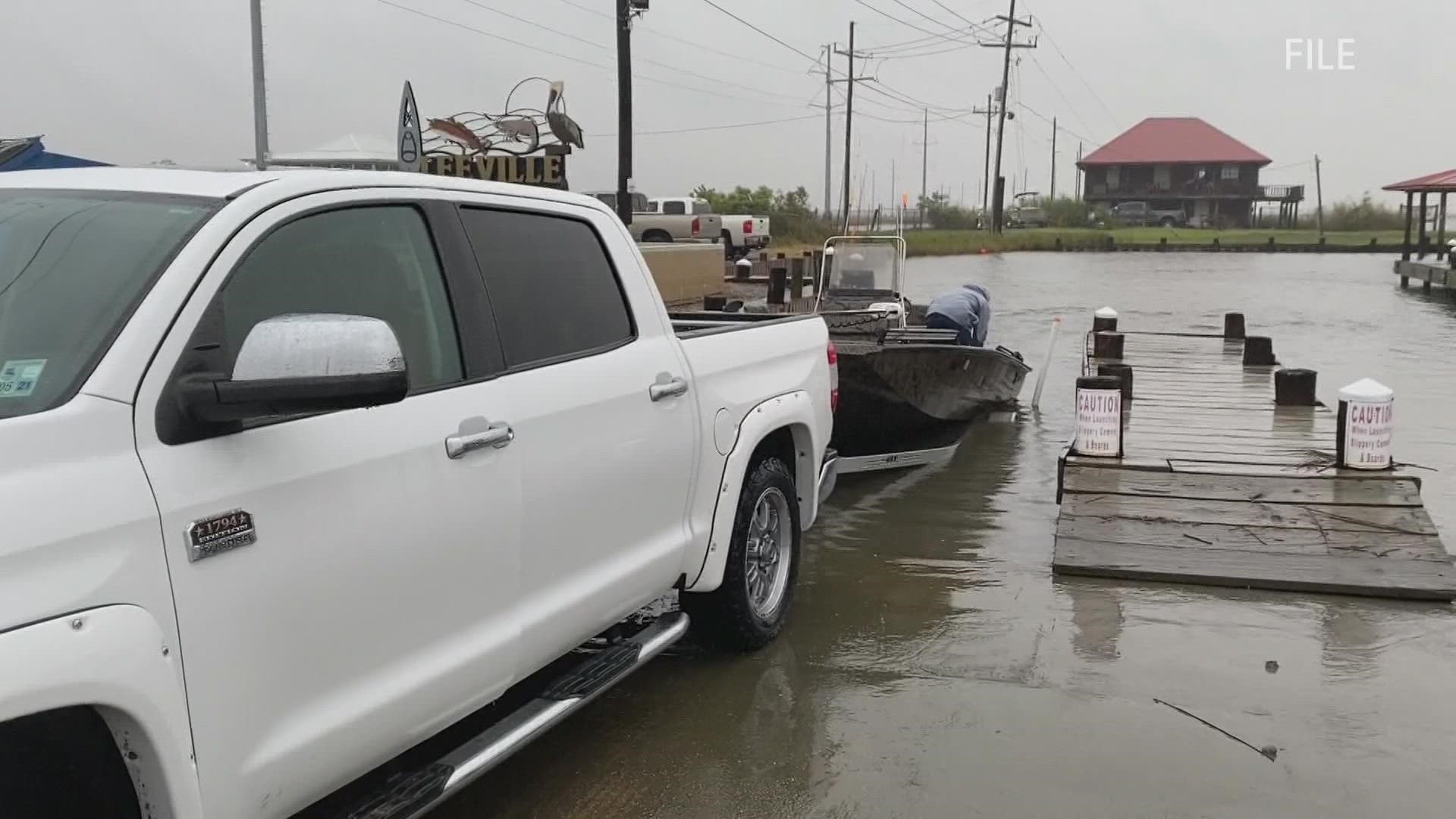
Mandatory evacuations have been called for all residents in Terrebonne, St. Charles and Lafourche parishes.
Mandatory evacuations have also been called for parts of other parishes, especially for anybody outside the levee protection system.
More Stories:
► Get breaking news from your neighborhood delivered directly to you by downloading the new FREE WWL-TV News app now in the IOS App Store or Google Play.