
NEW ORLEANS — High winds across the area late Tuesday were caused by a wake low.
So what is a "wake low"?
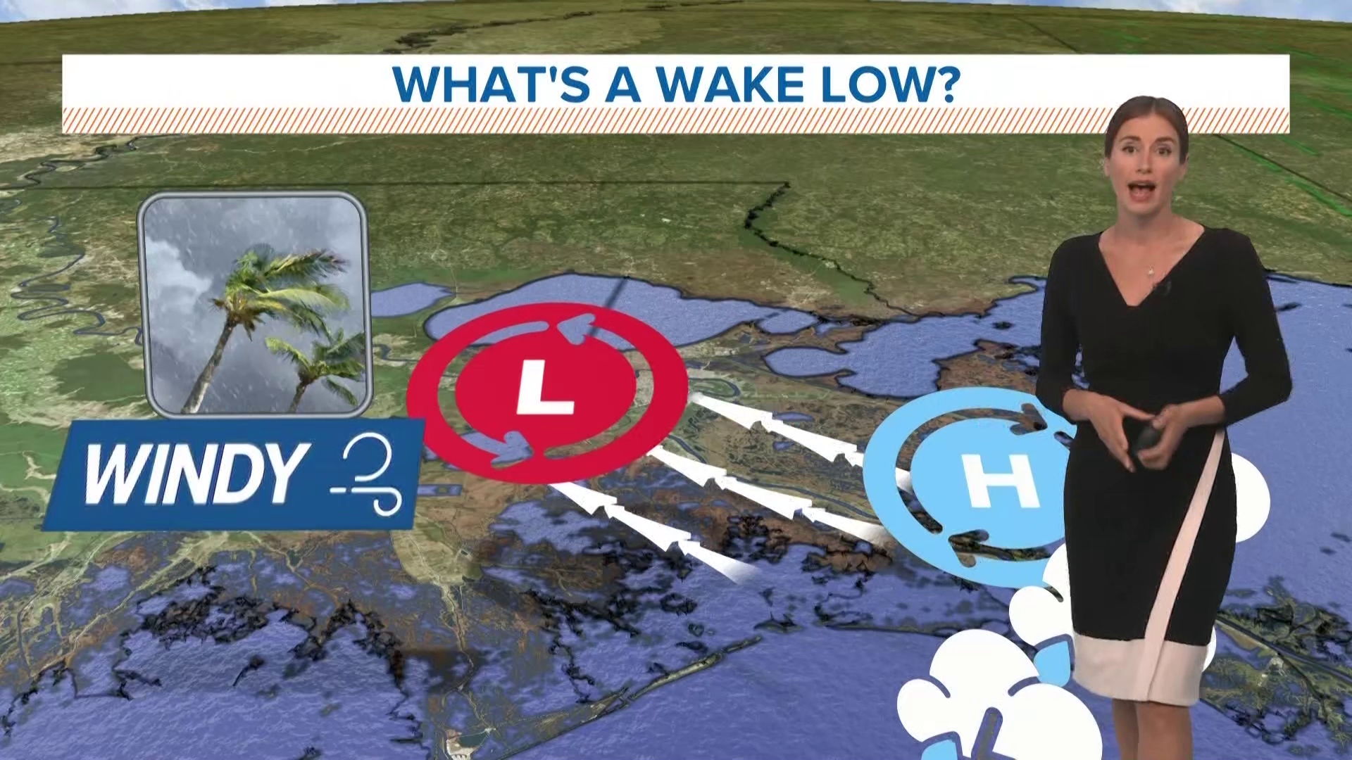
It’s a small area of low pressure that sometimes develops behind a line of thunderstorms.
The wake low forms about 30-50 miles behind the storms in a spot where the air is warming up. This creates a strong contrast between the wake low and an area of high pressure located along with the storms.
When there is a strong pressure gradient, air will rush from high pressure to low pressure. This generates strong winds which get more intense where the pressure is lowest.
Wake low set-ups can cause wind gusts of 60-70 mph or higher, as well as sustained winds of 40-50 mph for up to an hour or so.
Wake lows are not very common, but they are often responsible for high wind events that happen after a line of storms passes through, instead of when the storms first arrive.
► Get breaking news from your neighborhood delivered directly to you by downloading the new FREE WWL-TV News app now in the IOS App Store or Google Play.