
NEW ORLEANS —
New Orleans Latest Weather Forecast
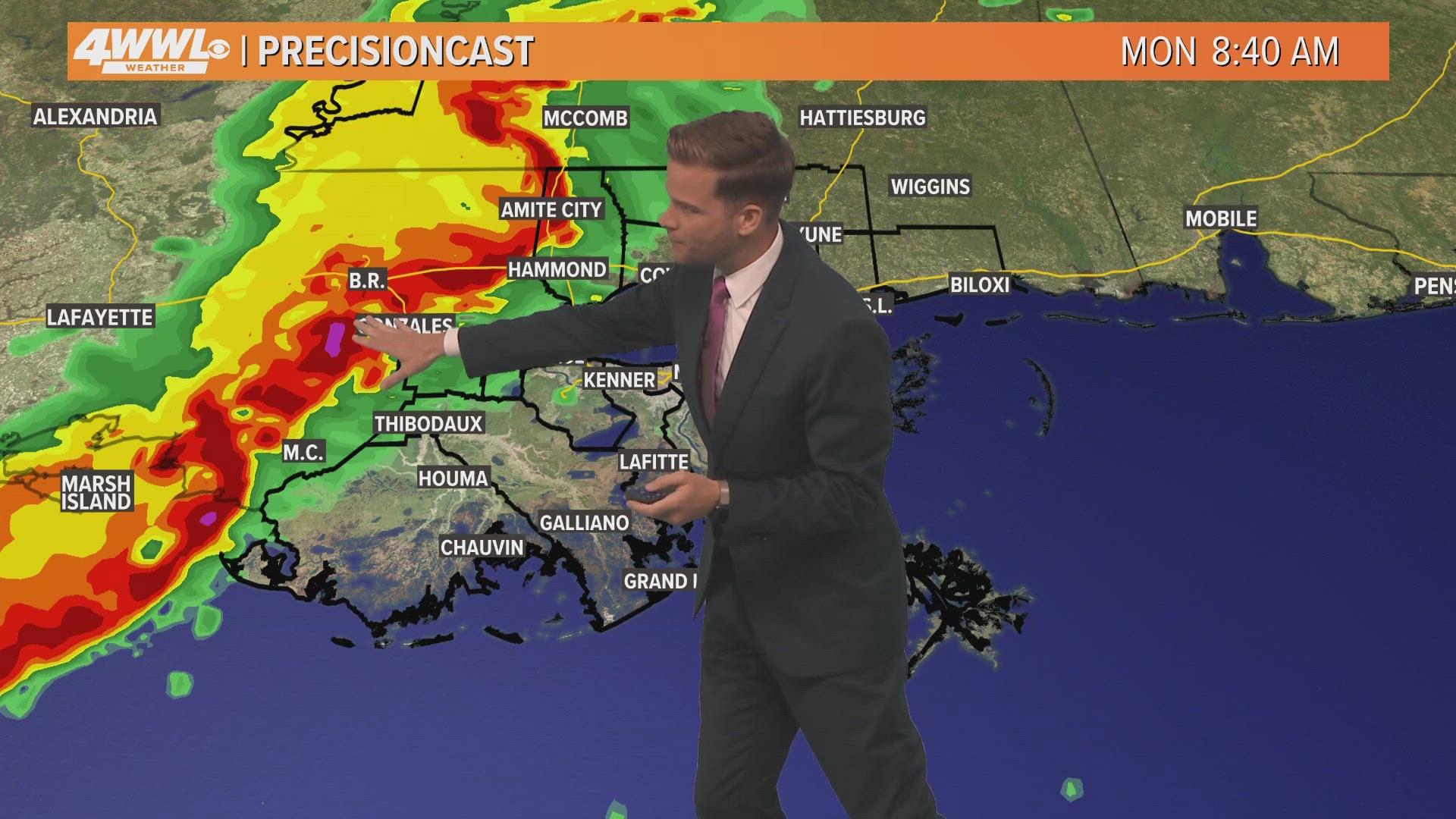
Our highest chance of rain this week comes on Monday as a storm system to our west sends us showers and thunderstorms. The earliest rain could start by late morning around 9 or 10 a.m., but the bulk of the rain will likely roll through from roughly 11 a.m. to 4 p.m.
The severe risk is not especially high since the system is expected to weaken as it arrives, but a few storms could bring high wind gusts and brief heavy rain. Rain totals look like up to 1-2 inches. Rain ends by the evening.
Tuesday and Wednesday look nicer with lower chances for rain and warm temperatures in the 80s.
A few spotty showers will be possible Thursday through Sunday although no day looks like a washout. Temperatures won't be at summer levels, but it may have a summery feel for the second weekend of Jazz Fest as we make it to middle and upper 80s with some humidity.
Detailed Forecast:
MONDAY:
80% chance scattered showers and storms. Warm, humid. Breezy. Low: S 72, N 69. High: 82.
TUESDAY:
Partly cloudy. 10% chance scattered showers and storms. Warm, humid. Low: S 70, N 67. High: 85.
WEDNESDAY:
Partly cloudy. 10% chance isolated shower. Warm, humid. Low: S 70, N 67. High: 85.
THURSDAY:
Partly to mostly cloudy. Mainly dry. Warm, humid, breezy. Low: S 69, N 66. High: 86.
FRIDAY:
Partly to mostly cloudy. 40% chance isolated shower. Warm, humid, breezy. Low: S 70, N 67. High: 83.
SATURDAY:
Partly to mostly cloudy. 20% chance isolated shower. Warm, humid. Low: S 70, N 67. High: 85.
SUNDAY:
Partly to mostly cloudy. 20% chance isolated shower. Warm, humid. Low: S 70, N 67. High: 85.