NEW ORLEANS — For Easter weekend, an upper low we've been closely following will head east across the Plains and develop a cold front.
As this nears us, expect a warmer and more humid air mass to begin moving in later Saturday as a warm front surges northward and by Easter Sunday highs will once again reach the mid 80s.
Also on Sunday there is a high likelihood for widespread severe weather.
A precise location is still uncertain, but a better focus on the Northshore and even parts of the metro area. The timing looks to be through the midday and afternoon hours, possibly into the evening.
All types of severe weather are possible. Damaging winds, tornadoes, and hail. The SPC has placed more of a focus over SE LA and S MS for Sunday, which could equate to an Enhanced (3 of 5) or even a Moderate (4 of 5) risk for severe storms for parts of our viewing area. We all need to pay close attention to the weather on Easter Sunday.

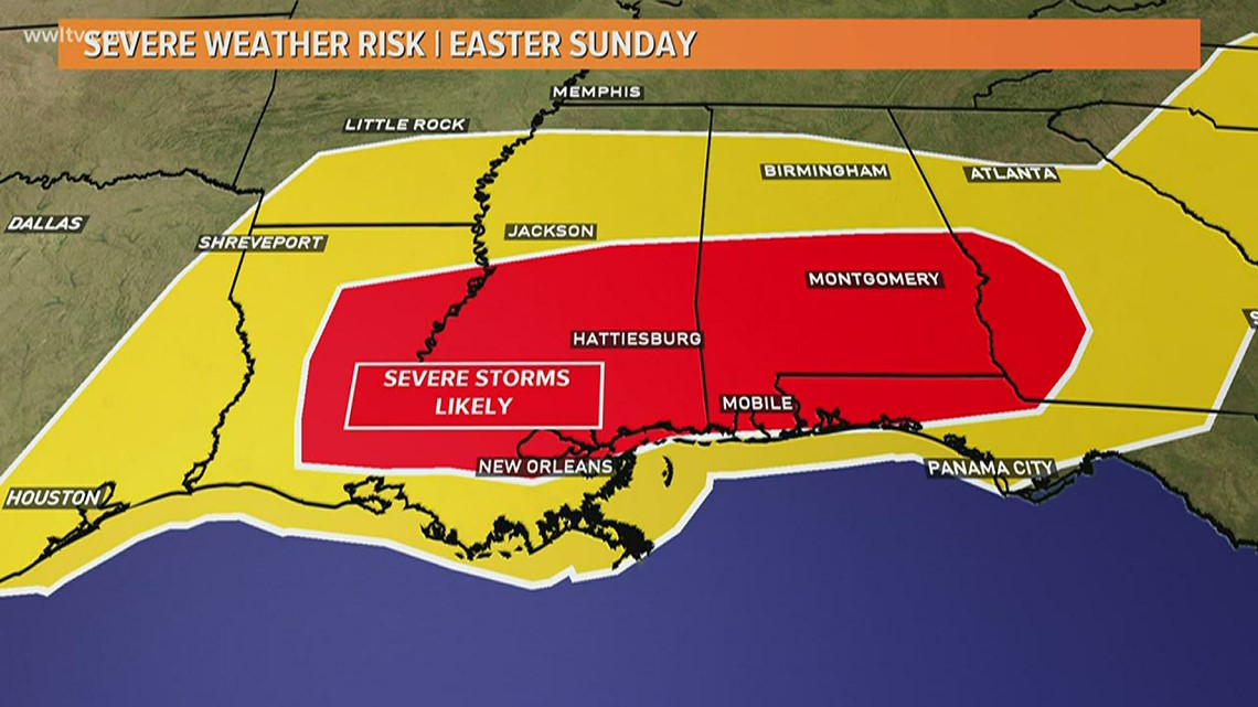
Heavy downpours could lead to some minor flash flooding. But the main threats will be the development of any tornadoes.
The Northshore and Kenner experienced a glimpse of powerful weather overnight Thursday. High winds from last night's storm knocked out power for at least 2,200 Entergy customers in Kenner by the lakefront and at least 1,000 customers in Tangiapahoa Parish, according to the utility's outage map.
No estimate was immediately available for when power would be restored in those areas.
If there is any silver lining to Sunday's storms it's that this will all occur during the day, so the storms shouldn't surprise anyone. Plus everyone will be home and able to monitor very closely.
Please stay with WWL-TV for the latest. Also remember to download the WWL-TV app.
► Get breaking news from your neighborhood delivered directly to you by downloading the new FREE WWL-TV News app now in the IOS App Store or Google Play.