
NEW ORLEANS — At Armstrong International Airport, temperatures are expected to tie the 102 record set 42 years ago. Even higher temperatures are expected to be recorded at Audubon Park and in Slidell.
Records for Kenner go back to 1946. So this is expected to be tied for the hottest day at least since then. Audubon is expected to hit 104 and Slidell is also expected to reach 104, on Wednesday.
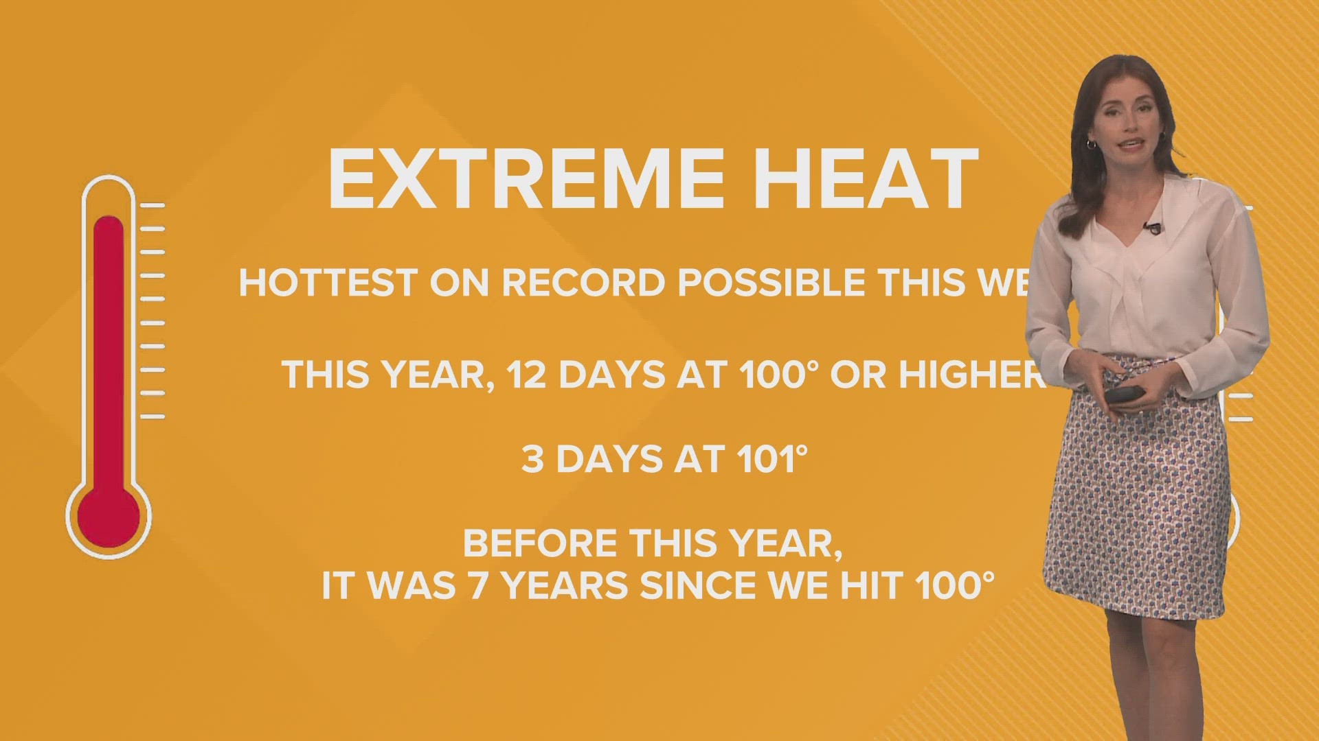
There have already been 12 triple-digit days this summer, three of which were at 101. This summer has been beyond what WWL-TV Chief Meteorologist Chris Franklin expected.
"The chance of seeing even one 100-degree day here is 0.3%," Franklin said. "So to see this many is incredibly rare."
Beyond Wednesday's 102-degree forecast for New Orleans, high temperatures are expected to stay in the triple digits until after Sunday.
The last time New Orleans saw triple digits was June 26, 2016. Last summer got close in late June, with a few days in the high 90s.
"Even the upper 90s here is pretty rare," Franklin said.
The previous record temperature of 102 degrees was set almost exactly 40 years ago on Aug. 22, 1980, according to the National Weather Service. The temperatures are expected to be right around there.
This summer, the high temperatures have resulted in over 260 wildfires, according to Gov. John Bel Edwards. In response, the governor issued a statewide burn ban in early August.
Six heat-related deaths also were reported in New Orleans this month. In response, Mayor LaToya Cantrell issued a city emergency. A week later, when temperatures spiked again, Edwards issued a statewide emergency.
July was not only the first time southeast Louisiana saw three triple-digit days in a row, but it was also the hottest month ever recorded on Planet Earth. Many around the world have been seeing record temperatures. Even Siberia, in Russia, near the Arctic Circle, has had triple-digit temperatures.
El Nino is partly to blame. Warm temperatures in the eastern Pacific Ocean, impact the weather around the world, moving the Pacific jet stream toward our area.
There has also been a heat dome, which is an area of high pressure that traps heat and stops rain from moving in. Southeast Louisiana has found itself sitting under the heat dome a few times this summer already, and it is coming back to this area this week.
These heat factors will help keep tropical storms away from Southeast Louisiana as long as they last.
According to the National Weather Service, El Nino in particular increases wind shear in the Atlantic basin, which can tear apart storm systems.
Southeast Louisiana typically sees lower temperatures than other major population areas in the state, like Baton Rouge. This is due to the proximity to the Gulf Coast.
The hottest temperature ever recorded in Baton Rouge was 110 degrees on Aug. 19, 1909. WBRZ has reported a 106-degree high for Wednesday.
► Get breaking news from your neighborhood delivered directly to you by downloading the new FREE WWL-TV News app now in the IOS App Store or Google Play.